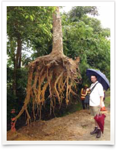
ENSPEC uses Ground Penetrating Radar (GPR) to locate tree roots and underground objects to generate scaled 3-dimensional images that allow clients to manage and mitigate damage to assets and tree root systems.
ENSPEC is a world leader in this technology, achieving superior results in locating and identifying tree roots.
 ENSPEC services with the GPR include
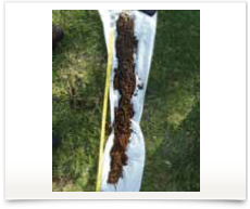
- Root architecture mapping
- Soil profiling
- Water table mapping
- Forensic investigations
- Archaeological surveys
- Civil Engineering Structural investigations
- Research (root health and moisture measurements)
- Service location including fibre optic cables
ENSPEC’s GPR is an impulse type RADAR that uses a wide spectrum frequency emitted in rapid pulses (approx. 100,000 pulses per second). The GPR is slowly moved over the test area, and the radar pulses (radio waves) are transmitted from the antenna through the ground. The pulses transmit harmlessly through the soil and are reflected by subsurface objects or variances back to the surface where they are received by the antenna. The RADAR detects the depth, conductivity, permittivity, density and location of subsurface objects.
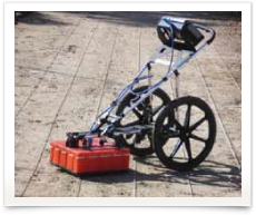
The data is collected and stored within the field computer for later analysis. Basic field analysis and interpretation can be conducted onsite using the field computer display. The quality of the results is influenced by the site conditions; it is preferable that the test area is relatively flat and clear of debris. The GPR testing can be conducted through almost any surface type e.g. bitumen, concrete, grass, mulch, bare earth or wood.
ENSPEC has a range of antennae that allow the GPR to penetrate variable depths and detect variable sized features dependent on client outcomes. The 900 MHz antenna is used for shallow detection (<1 meter) of small subsurface features (10 mm diameter); this
is generally used for archaeological detection services and research.
The 400 MHz antenna is used for detection of features greater than 20 mm diameter, and to depths of up to 3 meters in clay and 5 meters in sand; the 400 MHz antenna is generally used for tree root and subsurface utility detection. The 270 MHz antenna is generally used for deeper detection services (i.e. < 10 meters in sand and 5 meters in clay), and facilitates detection of broad soil profiles, water tables and the location of large rocks for civil works.
The 270 MHz antenna is also used for detecting moisture in large hay stacks.
Distinguishing between roots, subsurface utilities (i.e. pipes) and other subsurface features requires familiarity and experience with the equipment and data collected. ENSPEC provides clear and concise GPR data and information to its clients by utilising the latest software tools once the data is exported from the field computer.